

When Robots Can’t Afford to Be Wrong: The GPS Problem

The Everyday Pain of “Good Enough” GPS
We’ve all been there. You’re driving, and Google Maps says “turn right”… only it updates a second too late, and you miss the exit. Or Waze drops you at the back of a building that has no entrance. Or you’re wandering a parking lot, your iPhone insisting your AirTag is “right here” while you’re still circling in frustration.
These mistakes might seem small, but they point to a bigger problem: today’s location systems weren’t built for a world where machines move alongside us. GPS signals have to travel more than 20,000 kilometers from satellites in orbit, and by the time they reach Earth, they’re weak and prone to interference. Buildings, trees, even bad weather can nudge your location off by several meters. For people, that margin of error is usually tolerable. For machines that need split-second precision, like drones, self-driving cars, automated tractors, or warehouse robots, it’s a dealbreaker. A two-to-ten meter error is fine when you’re finding a café, but for intelligent machines that interact with each other, “close enough” isn’t good enough.

I’ve lost count of how many times GPS has left me circling blocks or second-guessing turns. And that’s just me, a human who can adapt. We’ve come to accept those little GPS errors as “normal.” Most of the time, we just shrug, reroute, and keep going. But every missed turn makes me think: if GPS can change the way we live while still being off by a few meters, how much bigger could the impact be if it were 100× more precise?
This is the problem a group of GPS veterans decided to take on. They knew the flaws in the system, and they knew that fixing them would unlock a new layer of precision the world hasn’t seen before.
What Exactly Is GEODNET?
GEODNET, short for Global Earth Observation Decentralized Network, is building the world’s largest network of GNSS (Global Navigation Satellite System) reference stations.
For decades, GNSS reference stations have been the backbone of high-precision positioning. Surveyors use them to map property lines, scientists use them to track tectonic shifts, and governments use them for air traffic control. The method works and it can cut GPS errors down to centimeters.
But there’s still no openly accessible, dense, global GNSS receiver network that everyone can use. GNSS signals are fragile. They’re easy to jam or spoof, yet we rely on them to protect more than $1 trillion worth of location-aware applications. Without a secure, spatially dense, cryptographically verifiable network, GPS remains vulnerable.
Government-run stations cover certain regions but not everywhere. In the U.S., there are about 2,000 sites; in Africa, fewer than 200. That means entire continents are still blind spots.
Commercial RTK services like Trimble or Topcon deliver great precision, but at a cost. Subscriptions can run up to $10,000–15,000 a year per device, making them viable only for industries like aviation or industrial agriculture.
Volunteer networks have popped up too, but they rely on goodwill. Without economic incentives, growth is slow, coverage is patchy, and if the central organizer disappears, the whole thing collapses.
So while the technology has been proven for years, the model has never scaled. That’s the problem GEODNET is solving.
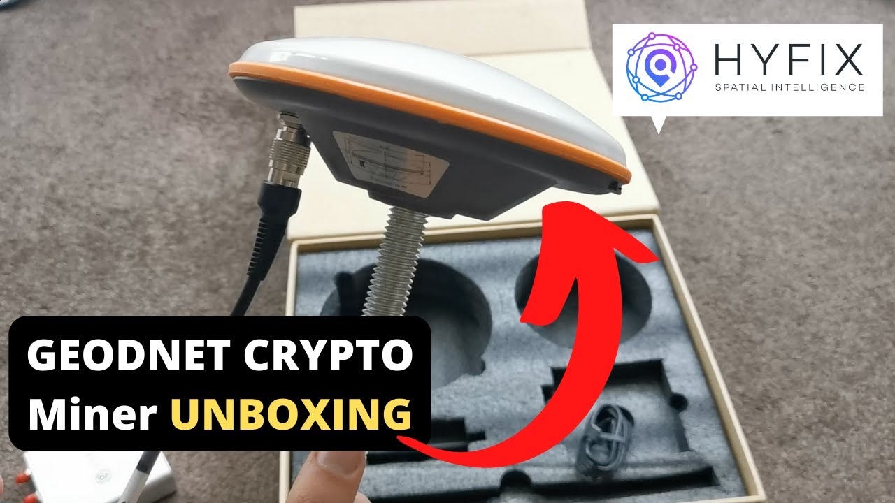
You don’t need to be a government agency or a big corporation to participate. Anyone can run a Satellite Miner. Put one on your rooftop and you’re instantly part of a global network, helping expand coverage for everyone else. The network then rewards you with $GEOD tokens, which keeps the system sustainable and growing.
That’s a huge shift. What once cost over $10,000 a year in private GPS subscriptions is now being replaced by an open, community-powered network that’s affordable and continuously expanding.
And it’s not just a theory. GEODNET has been live since 2021. The community has already deployed more than 19,000 stations across 145 countries, generating nearly $4M in annual recurring revenue. The long-term goal is 100,000 stations worldwide, about 20x larger than the biggest government-run systems today.
Under the Hood: How GEODNET Works
GEODNET is now the largest precision GPS network on the planet. And it didn’t get there through government budgets or corporate monopolies. It’s powered by everyday people, one rooftop antenna at a time.
So how does all of this actually work? At first glance, GEODNET might just look like rooftop gadgets making GPS sharper. But it’s more than hardware. Each miner is part of a global mesh that listens to satellites, spots errors, and shares corrections in real time.
At the heart of GEODNET are three kinds of nodes that each play a different role, but none can stand on its own. It starts with the miners. These are rooftop GNSS antennas that act like sensors on the ground. Because they know their exact location, they can tell when satellites are slightly off and generate correction data in real time.
But raw data alone isn’t enough. That’s where validators come in, essentially acting as the referees of the system. They double-check the miners’ output to make sure it’s accurate and authentic. If someone tries to spoof a signal or feed in low-quality data, validators catch it before it spreads.
Once the data is cleaned and verified, it needs to be delivered to the people and machines that actually use it. That’s the job of service nodes. They stream those corrections directly into apps, drones, tractors, or any device that needs centimeter-level precision. In practice, they’re the bridge between GEODNET’s secure backend and real-world applications.
The magic is in how these roles interlock: miners generate truth, validators protect it, and service nodes deliver it. If one fails, the others can’t function. Together, they form a chain of trust that keeps the whole system reliable.
All of this runs on a blockchain. Instead of one central authority deciding who to trust, GEODNET secures itself with Proof of Location (POL) and Proof of Accuracy (POA) to verify data quality, while Proof of Stake (POS) keeps validators honest. Add incentives on top, and the loop sustains itself: miners earn $GEOD tokens for contributing good data, validators earn for keeping the system secure, and 80% of customer revenue is used to buy back and burn tokens, tightening supply and rewarding participation.
GEODNET also bakes in clever mechanics to make growth faster and smarter. The world is divided into hexagons, with miners rewarded for expanding into new areas instead of crowding into the same spot. High-performing stations can mint Location NFTs to secure their coverage.
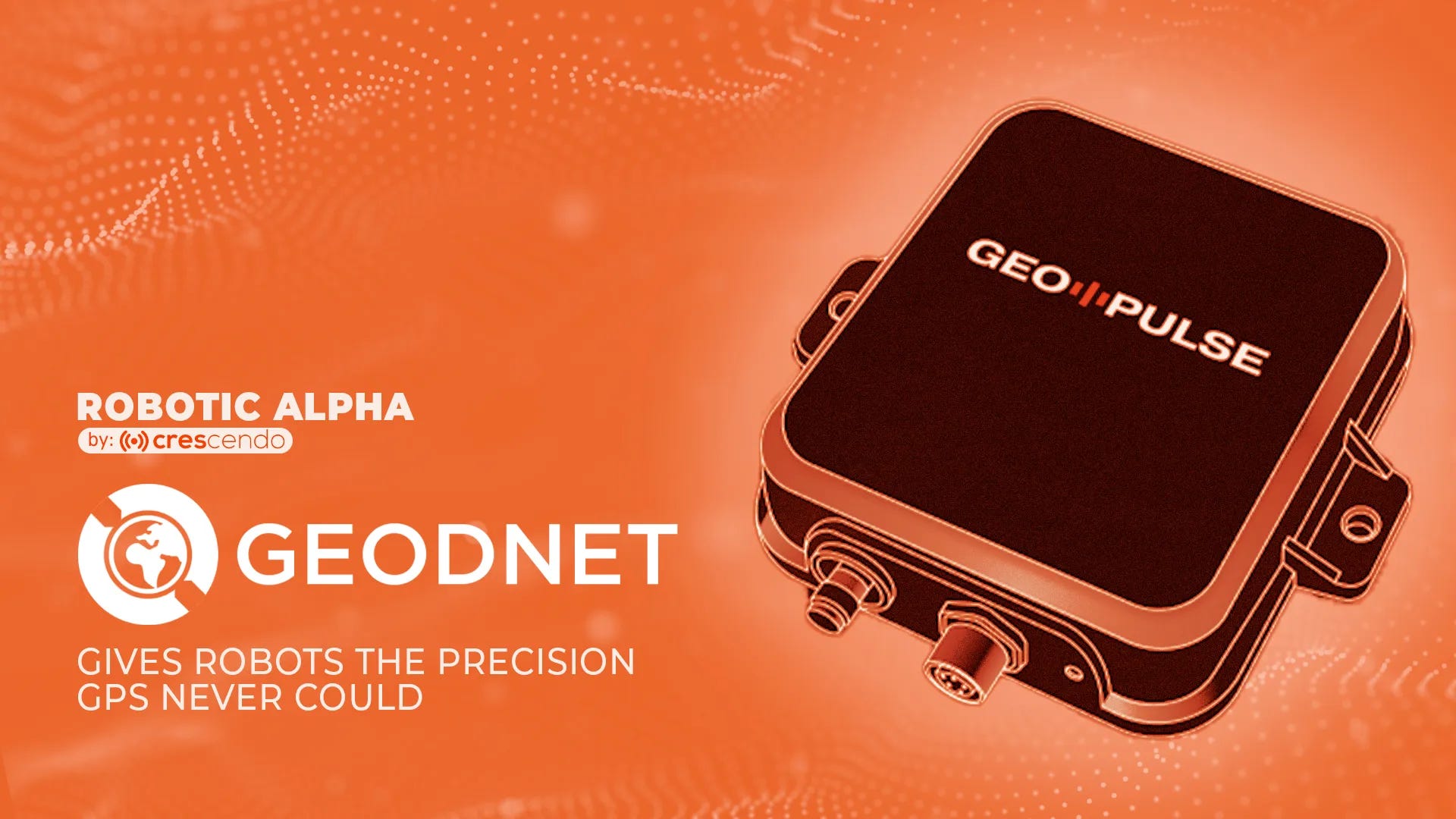
Then there’s GEO-PULSE, GEODNET’s own navigation device that doubles as a network expander. Marketed as the world’s most accurate consumer car navigator, it delivers 10x more precision than GPS, down to just 10 cm. For everyday drivers, it means no more missed toll exits or wandering parking lots. For fleets and ride-sharing apps, it’s a low-cost way to unlock lane-level accuracy.
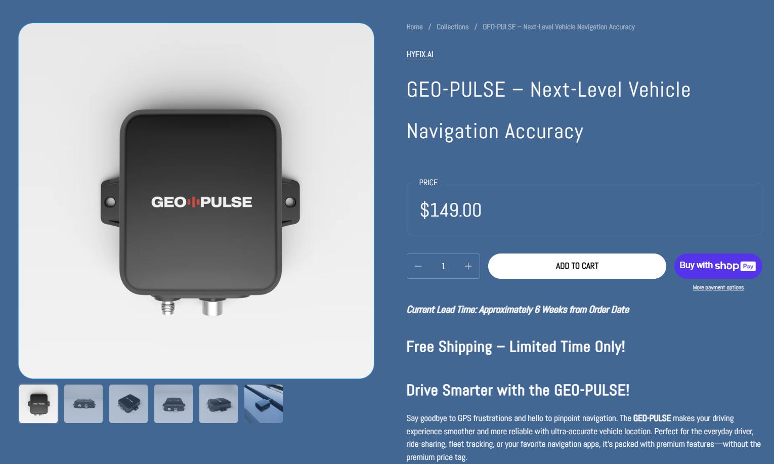
Every GEO-PULSE unit is more than just a gadget, it’s also a roaming sensor. Cars equipped with GEO-PULSE that move through underserved regions automatically feed positioning data back into the GEODNET network. In other words, daily commutes, deliveries, and road trips quietly extend coverage.
And it’s affordable: at $149, bundled with one year of GEODNET RTK access, GEO-PULSE shows how consumer hardware and DePIN incentives can reinforce each other. Drivers get a smoother navigation experience, and the network grows without waiting for governments or corporations to build the infrastructure.
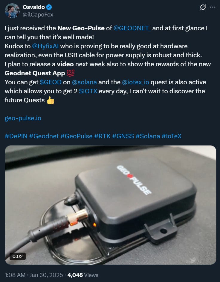
Source: https://x.com/ilCapoFox/status/1884649853583581587
The result is more than just sharper GPS. It’s a self-scaling, self-correcting geospatial backbone, a network that expands because people are rewarded to grow it, and stays honest because every piece checks the others. Centralized networks never managed that. GEODNET is showing it can.
Once you understand what GEODNET is doing behind the scenes: miners catching tiny GPS errors, validators checking the data, and service nodes delivering clean corrections, the natural question is: so what can you actually do with centimeter-level accuracy?
The answer: quite a lot.
Why Centimeter Accuracy Changes the Game
People deserve better. It feels absurd to spend thousands on the latest cars, drones, or phones, only to have them tripped up by the same old GPS bottleneck: accuracy. Satellite signals are weak, easily thrown off by buildings, trees, or even bad weather. For decades we’ve lived with “good enough,” but good enough for humans isn’t good enough for machines. GEODNET fixes this.
For us, the benefits are immediate. Navigation becomes stress-free. Your phone knows your lane, not just your street. No more guessing which toll booth to take, or like I’ve experienced: getting pulled over because a laggy map left me in the wrong lane at a busy intersection.
Augmented reality also stops feeling like a toy. Right now, digital arrows float awkwardly near buildings, and trackers leave you circling parking lots. With centimeter precision, overlays pin exactly where they should, and AirTags walk you straight to your keys instead of “somewhere nearby.”
But the real shift isn’t about us, it’s about machines. Unlike people, robots can’t adapt when GPS is off by a few meters. That margin of error is more of a hazard than an inconvenience. A tractor can’t “eyeball” straight rows, a drone can’t land on “roughly the right spot,” and a warehouse robot can’t afford to guess which aisle it’s in. They need precise, trusted location every single time.
GEODNET is the first project to attack this problem at global scale. It takes the proven method of high-accuracy GNSS corrections; something governments and surveyors have relied on for decades, and decentralizes it into a dense, cryptographically secure, economically sustainable network. No one else is doing this.
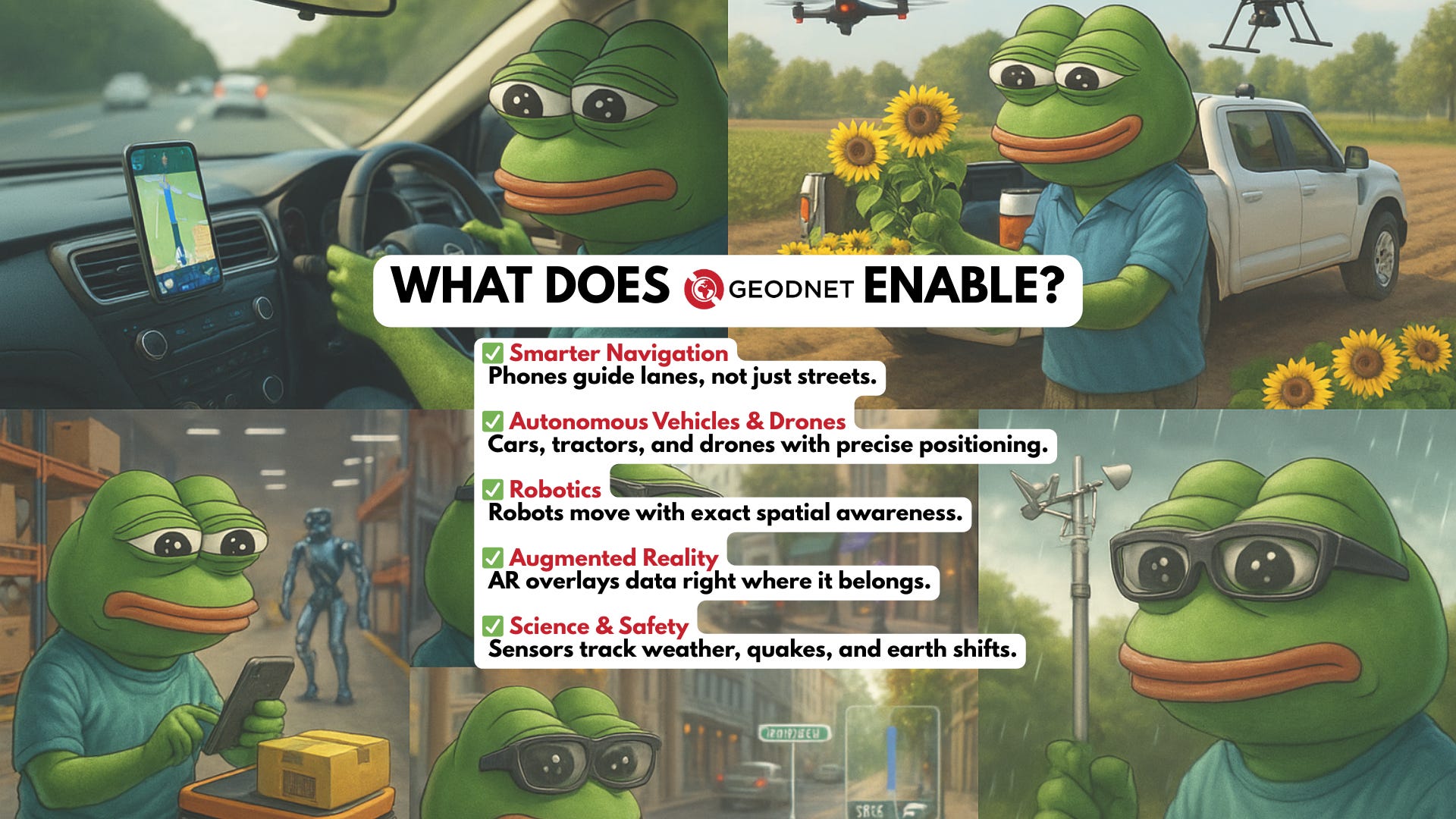
The upside is clear: as robotics moves from niche to mainstream, the demand for centimeter-level location will spike across every sector. Self-driving fleets, drone delivery, precision farming, construction automation, even AR glasses: all of them depend on location you can trust every second. GEODNET is positioning itself as the invisible backbone that makes that future work.
In short, if robots are the next trillion-dollar wave, then precise, reliable location is the foundation they cannot move without. GEODNET is tackling it now, the question is what new industries appear once that dependency is solved.
About Conglomerate
Conglomerate is a seasoned content writer and KOL in the crypto x AI x robotics space. Web3 gaming analyst, core contributor at The Core Loop, and pioneer of the onchain gaming hub and Crypto AI Resource Hub.
Book A Call
Curious how robotics, gaming, and AI can drive your next growth wave? Let’s talk. Book a call with Crescendo’s BD lead Filippo